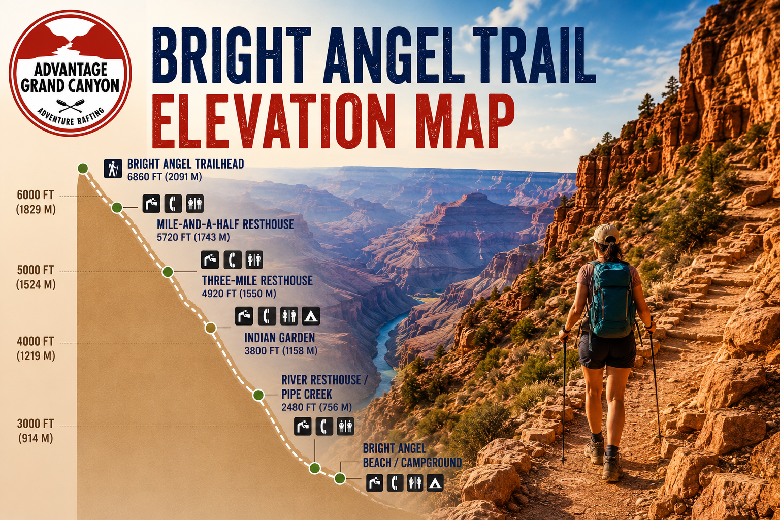
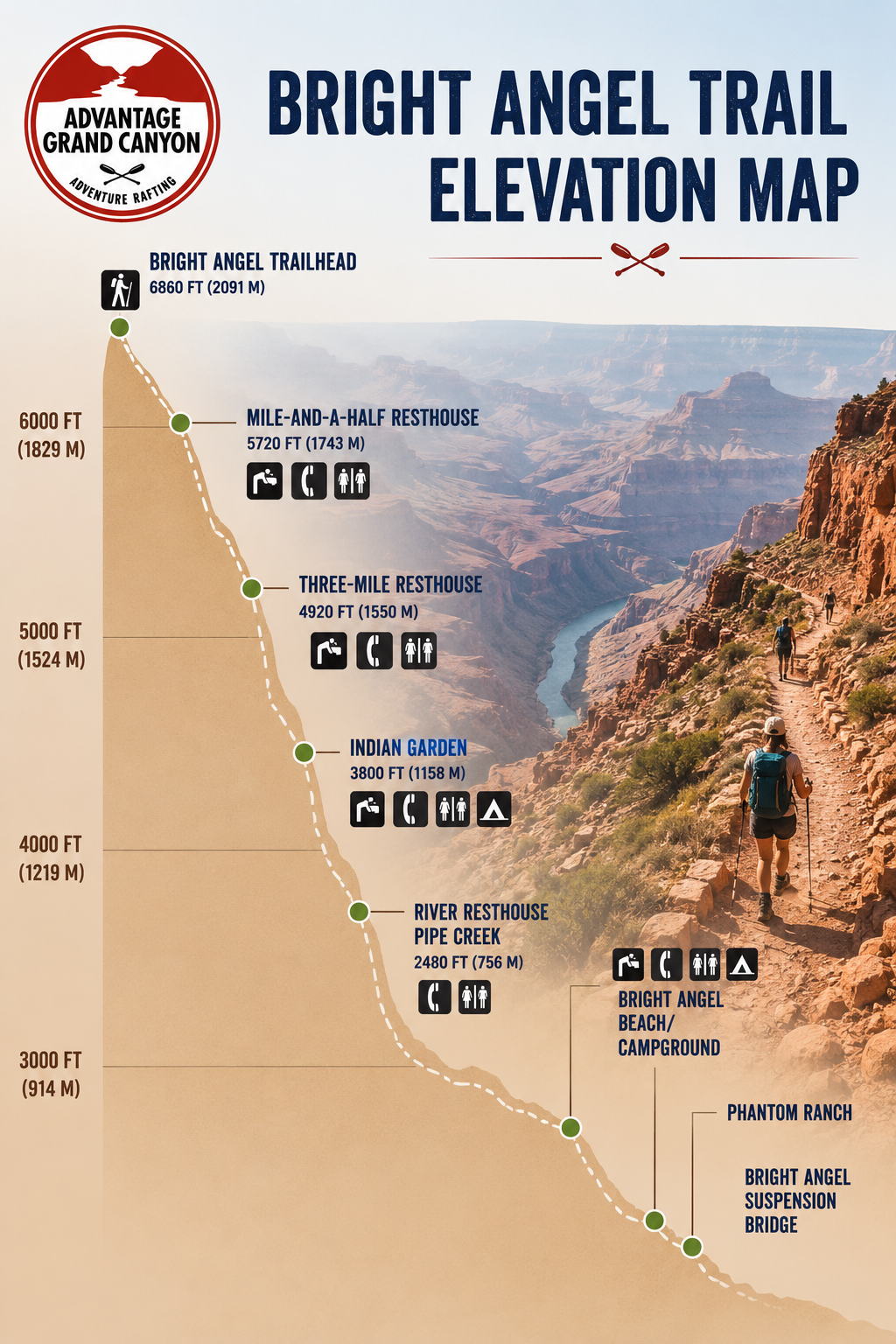
The Bright Angel Trail is one of the most iconic hiking routes in Grand Canyon National Park, descending from the South Rim to the Colorado River. Understanding the trail’s elevation profile is essential for planning a safe and enjoyable hike, as the route involves a significant elevation change of more than 4,300 feet (1,300 meters). Along the trail, hikers pass key landmarks including the Mile-and-a-Half Resthouse, Three-Mile Resthouse, Indian Garden (Havasupai Gardens), River Resthouse, Bright Angel Campground, and Phantom Ranch.
While the descent may seem manageable, the climb back to the rim is physically demanding, making proper preparation, hydration, and pacing critical for a successful adventure.
Over 4.5 million spectators visit the Grand Canyon National park each year. Few of them, about 1% make it to the bottom of the canyon via the Bright Angel Trail and spend a night below the rim. Close to 25,000 people also raft Grand Canyon and about half of these trips start or end at river mile 88 (Boat Beach and Phantom Ranch) or 89 (Pipe Creek Beach) where the trail head either begins or ends depending on which way you are traveling. Bright Angel Trail elevation fluctuates significantly and gets quite steep and challenging. The lowest point of the trail is at Bright Angel Beach also know known as Boat Beach with an elevation of 2480 feet. The top of the Bright Angel trailhead is 6,860 feet in elevation for a difference of 4,314 feet about 966 feet shy of one vertical mile. The Bright Angel trail hike includes multiple rest stops at various elevations. When descending the trail at 6860 ft, the first rest stop named Mile-and-a half resthouse is an elevation loss of 1,131 feet. The next stop is Three Mile resthouse which sits at 4,748 feet or another 981 feet beneath 1.5 mile. Indian Garden follows at 3,800 feet in elevation or a loss of another 948 feet. Continuing the hike descent another 3.1 miles reaches River Resthouse where you can actually touch the Colorado river.
This resthouse is at 2,480 feet in elevation and 1,320 foot loss from the Indian Gardens. When considering distance and elevation loss/gain, the steepest part of the Bright Angel Trail is the first 1.6 miles which sees the biggest elevation change. To put things in perspective, the Bright Angel Trail is steeper and a longer hike then the final summit on a Kilimanjaro hike. This trail is well manicured, but has it’s challenges with steep switchbacks and the element of heat during the summer months. It is crucial to bring plenty of snacks, electrolytes, water and to be properly prepared for the elements.